Cornell’s Institute for Resource Information Sciences has a website with digitized images of aerial photographs for four central New York counties dating back as far as 1936.
While the images are mere gray smudges compared with the local.live.com aerials I blogged about earlier. (Example below.)
While I can discern a few intersting facts about our house from these old aerials, the most astonishing thing you notice navigating through the aerials to find and zoom in on this spot is how much of the land that was open pasture or cropland is now overgrown. It’s no wonder we have so many more deer now than then.
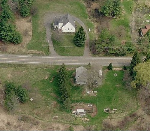
Spring 2006 local.live.com view. (All images, top is north.)
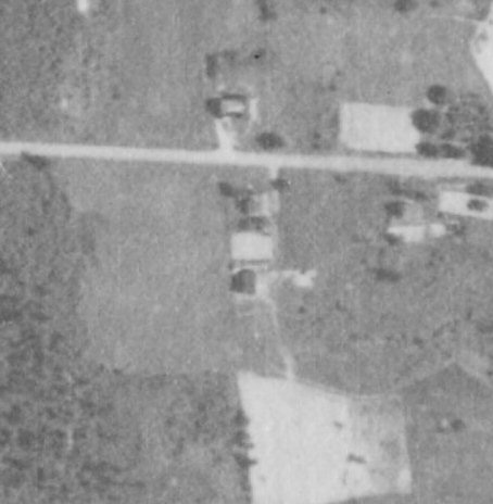
1991: The row of Norway spruce to the west of the house and church across the street make it easy to get oriented. But there are other trees along the road — including a very large one northwest of the house — that weren’t there when we moved in in 1999.
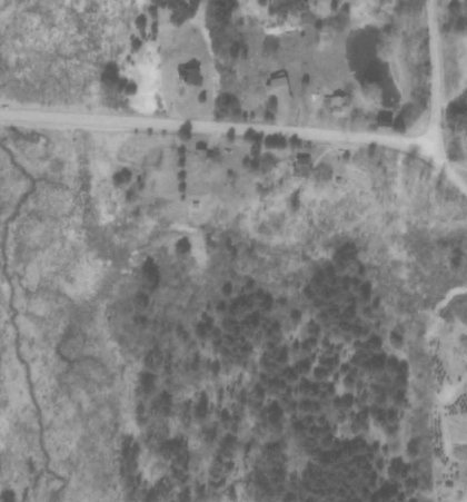
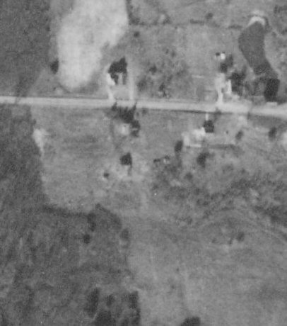
1980: The home east of the church isn’t hasn’t yet been built. The Norway spruce haven’t been planted. Looking at the old outbuilding south of our house, it appears there’s a wide concrete apron around the south and east sides and a rectangular enclosure south of that.
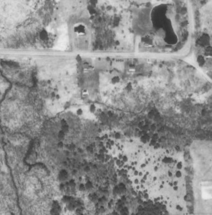
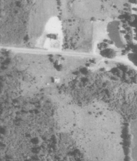
1964: This shot looks like it was captured out of the corner of the fisheye lens on the plane, looking east. And unlike the other pictures, it’s taken during the growing season. You can see the Norway maple south of the house is already large. The outbuilding south of the house looks much larger than the modest shed that remains on that location, and there looks to be a smaller shed southwest of that. Notable how many trees there are between the open area west of the house and the wetland farther west. And how many trees there aren’t to the south and southeast — although it looks like scattered trees are already starting to move in to what looks like it may have been pasture. I had thought that area may have been orchard because you can find occasional apple trees scattered through the woods in that area.
1954: OK. Now we’re back literally before my time. Even with no leaves on the trees, there are more distinct edges between field and forest — a good sign that this area was being managed for pasture or hay. What I can’t figure is how it looks like they worked across the stream and wetland south of the outbuilding. I surmise that the wetland had a lower waterlevel half a century ago.
1934: Hmmm… This is the middle of the Republican Great Depression. Is that big rectangle between the house and outbuilding a vegetable garden? It looks like there is a well-warn path from the outbuiding south to what looks like a fenced-in pasture. Maybe that outbuilding is a stable and the open area a horse pasture? There was still a lot of animal power used in 1934.
Would love to see earlier aerials. But I think taking pictures from planes in ’34 was pretty cutting-edge technology. I don’t know of any earlier images of the property, either. May have to visit the History Center in town sometime soon.
Original maps:

Craig, those old aerials are great. I’ve been all over that site, however, and I can’t find them. Are they available to the public?
Interesting stuff! I love looking at old aerials and finding how things have changed. Interesting about the farming vs the forests!
Jane: I neglected to plug in the direct link to the maps. They’re here:
http://aerial-ny.library.cornell.edu/ny/index.cfm
I also fixed it above.